Image, Shutterstock; Radio731 logo courtesy of Forever Communications; Lindsey Electric logo courtesy of Lindsey Electric; designed by TTR
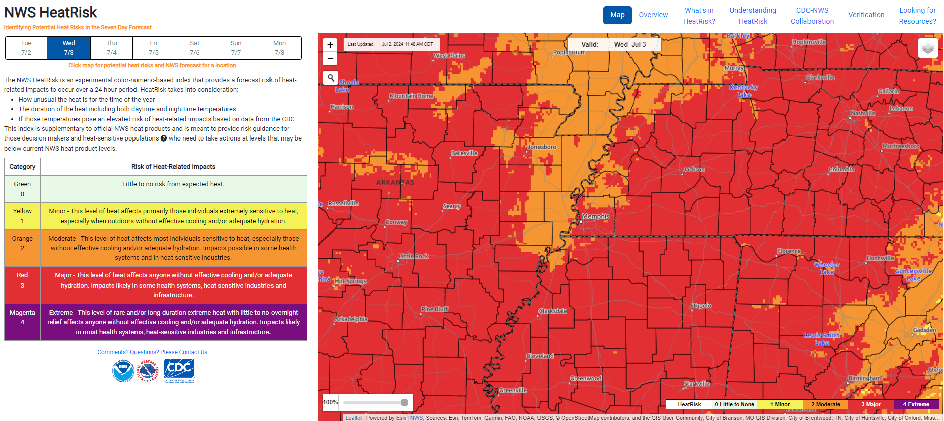
The National Weather Service in Memphis said Tuesday that “dominant ridge will continue to build across our area, increasing heat index values to a dangerous level” Wednesday and Thursday.
Wednesday, July 3:
- An Excessive Heat Watch will be in effect from 10 a.m. to 8 p.m. Wednesday) for northeast Arkansas, portions of northern Mississippi , and portions of West Tennessee
- Heat index values ranging between 110-116 F in these areas
- The rest of the Mid-South will likely need a Heat Advisory as heat index values range between 105-109 F
- This is forecasted to be the hottest day of the week.
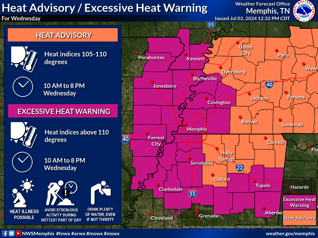
There is a Marginal Risk (level 1/5) for severe weather in effect for northeast Arkansas, the Missouri Bootheel, and northwest Tennessee. The primary threats include damaging winds (60 mph gusts) and localized heavy rainfall. Storms will approach from the N/NW Wednesday afternoon into the evening hours.
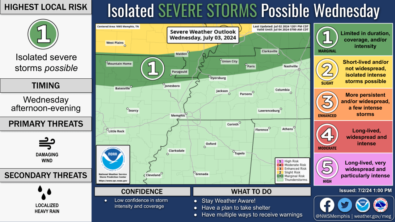

Graphic courtesy of The National Weather Service in Memphis
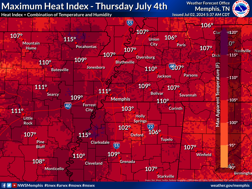
- An Excessive Heat Warning may be needed for portions of northeast Arkansas, the Mississippi Delta, and portions of southwestern Tennessee
- Heat index values ranging between 110-115 F in these areas
- The rest of the Mid-South may warrant a need for a Heat Advisory as heat index values range between 103-109 F
There will also be a Slight Risk (level 2/5) for severe weather in effect for northeast Arkansas, the Missouri Bootheel, and northwest Tennessee. Primary threats include damaging winds (60mph gusts) and locally heavy rainfall Thursday evening.
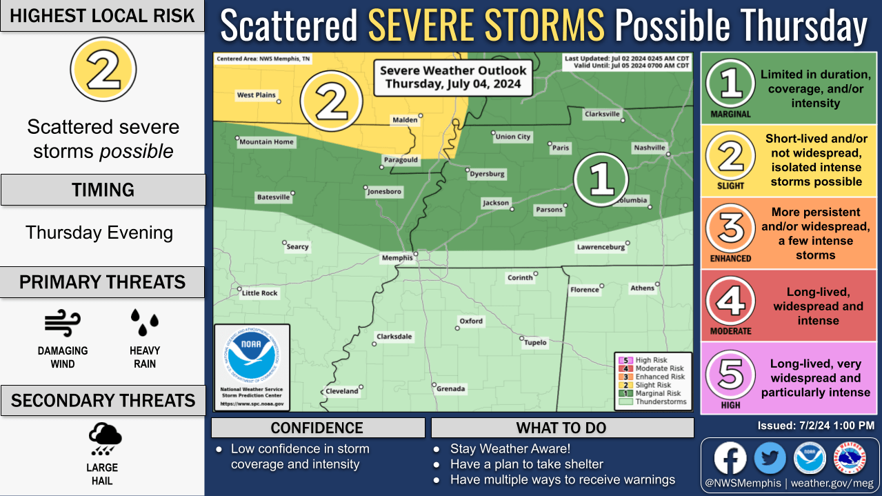
NWS said hot and humid conditions continue Thursday, but higher uncertainty given the chance for thunderstorms and cloud coverage. A decision will be made to issue heat headlines for the holiday around this time tomorrow.
Our severe weather coverage is sponsored by Lindsey Electric, your Generac generator dealer in Jackson. Call 731-423-1580, or visit lindseyelectricservice.com. Lindsey Electric – The authority for your power solutions.
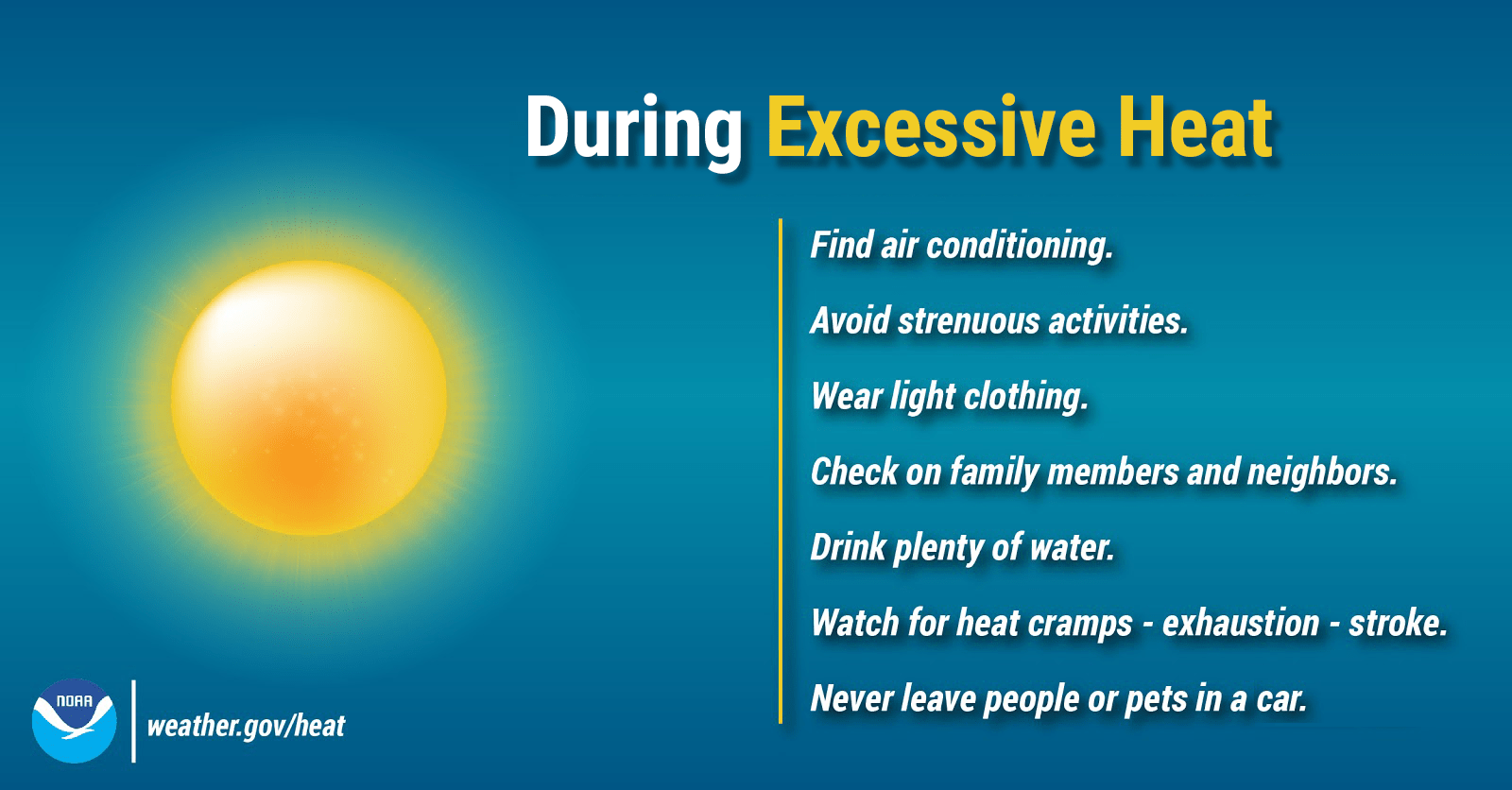
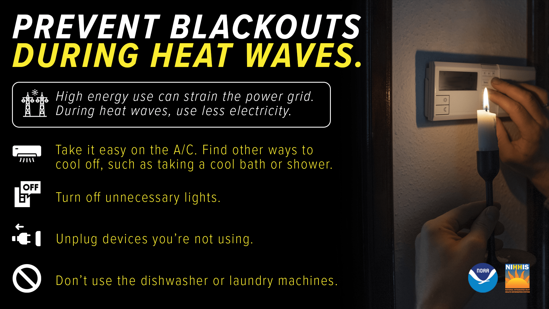
PREPARE, PREVENT AND PROTECT (HEAT EDITION):