Image, Shutterstock; Radio731 logo courtesy of Forever Communications; Lindsey Electric logo courtesy of Lindsey Electric; designed by TTR
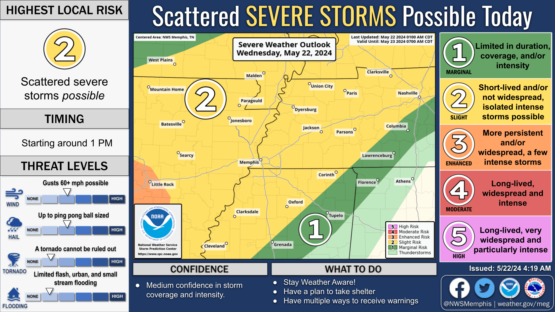
Active weather will continue this week as severe weather is possible for the next several days, according to the National Weather Service in Memphis. Locally heavy rainfall is also possible with 4-6 inches is the forecast across the Mid-South for the next several days.
Today, Wednesday 5/22: There is a Slight Risk for severe weather in effect for most of the Mid-South. Damaging winds and large hail are the primary threats. Storms are expected to begin firing up around 1 p.m. Wednesday afternoon before discrete cell development later Wednesday evening.
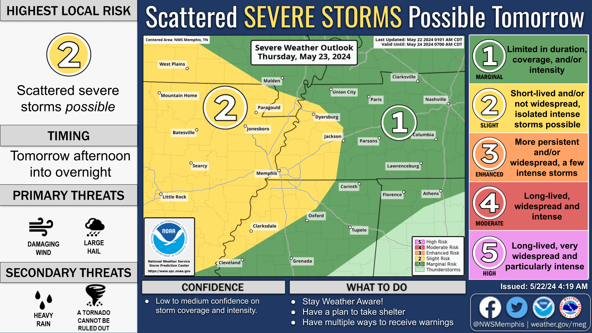
Thursday 5/23: There is a Slight Risk for severe weather in effect for eastern Arkansas, a portion of West Tennessee, northwest Mississippi, and the Missouri Bootheel. Damaging winds and large hail will be possible Thursday afternoon and possibly into the overnight hours.
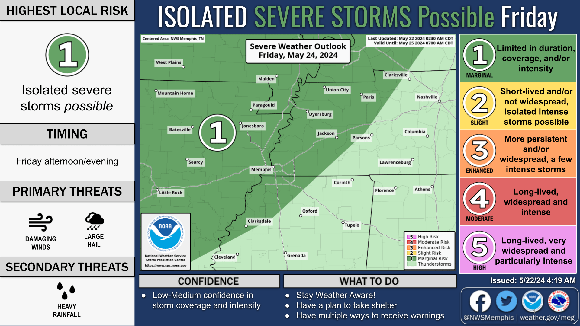
Friday 5/24 : There is a Marginal Risk for severe weather in effect for eastern Arkansas, most of West Tennessee, northwest Mississippi, and the Missouri Bootheel. Damaging winds and large hail are possible Friday afternoon into the evening.
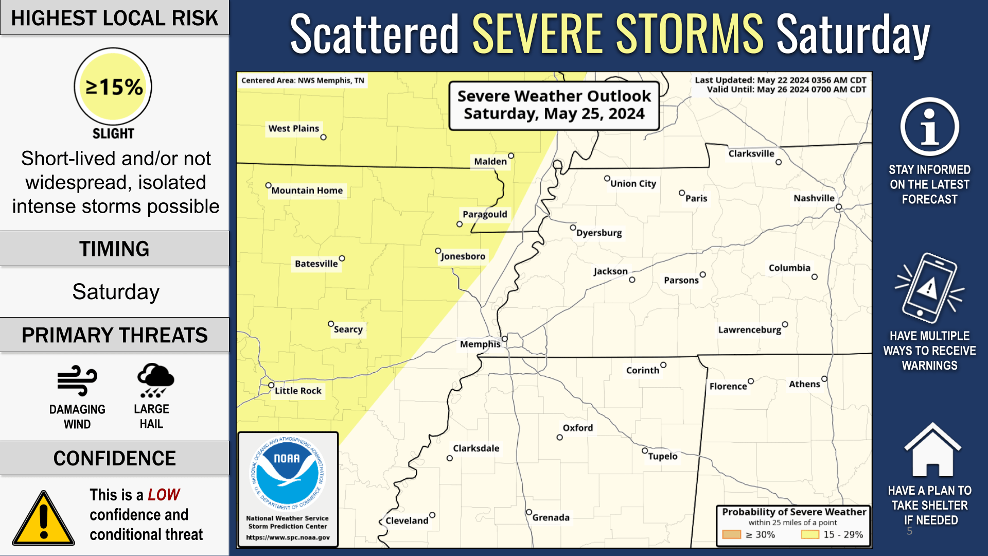
Saturday 5/25: A Slight Risk for severe weather is possible Saturday.
Sunday 5/26: An Enhanced Risk for severe weather is possible Sunday.
Our severe weather coverage is sponsored by Lindsey Electric, your Generac generator dealer in Jackson. Call 731-423-1580, or visit Lindsey Electric Service dot com. Lindsey Electric – The authority for your power solutions.