Logo courtesy of Lindsey Electric; Radio 731 logo courtesy of Forever Communications; Image, Shutterstock
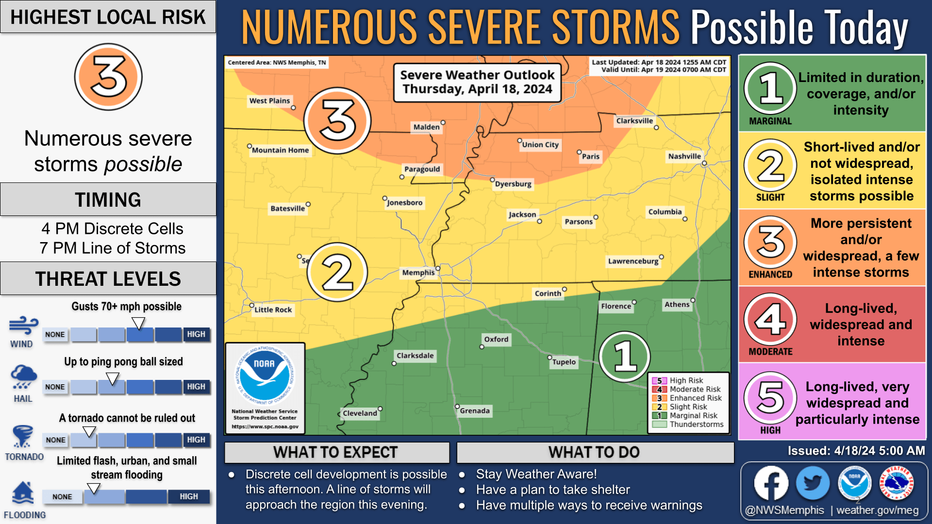
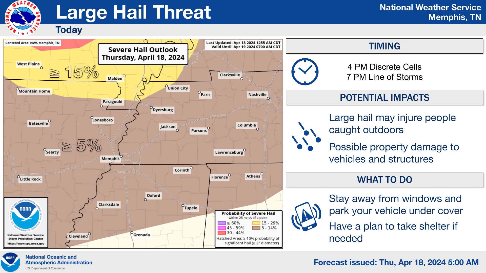
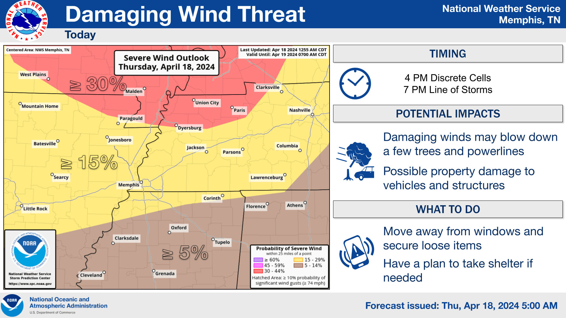
The National Weather Service in Memphis said an ENHANCED RISK (level 3 out of 5) for severe weather is in effect for portions of northwest Tennessee, northeast Arkansas, and the Missouri Bootheel. Focus has shifted to the afternoon round with damaging winds and large hail as the primary threats.
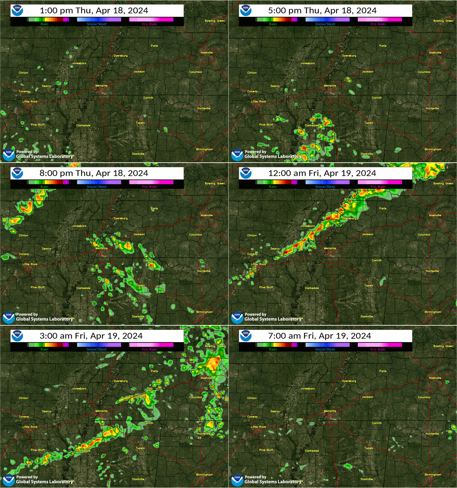
- Discrete storm development is becoming an increasing concern this afternoon. Storms could fire up as early as 1 PM, but most likely timing is beginning at 4 PM.
- Primary threats include damaging winds and large hail.
- A line of storms looks to approach from the northwest around 7 PM.
- The impacts associated with this line may be limited due to arrival time and atmospheric stabilization.
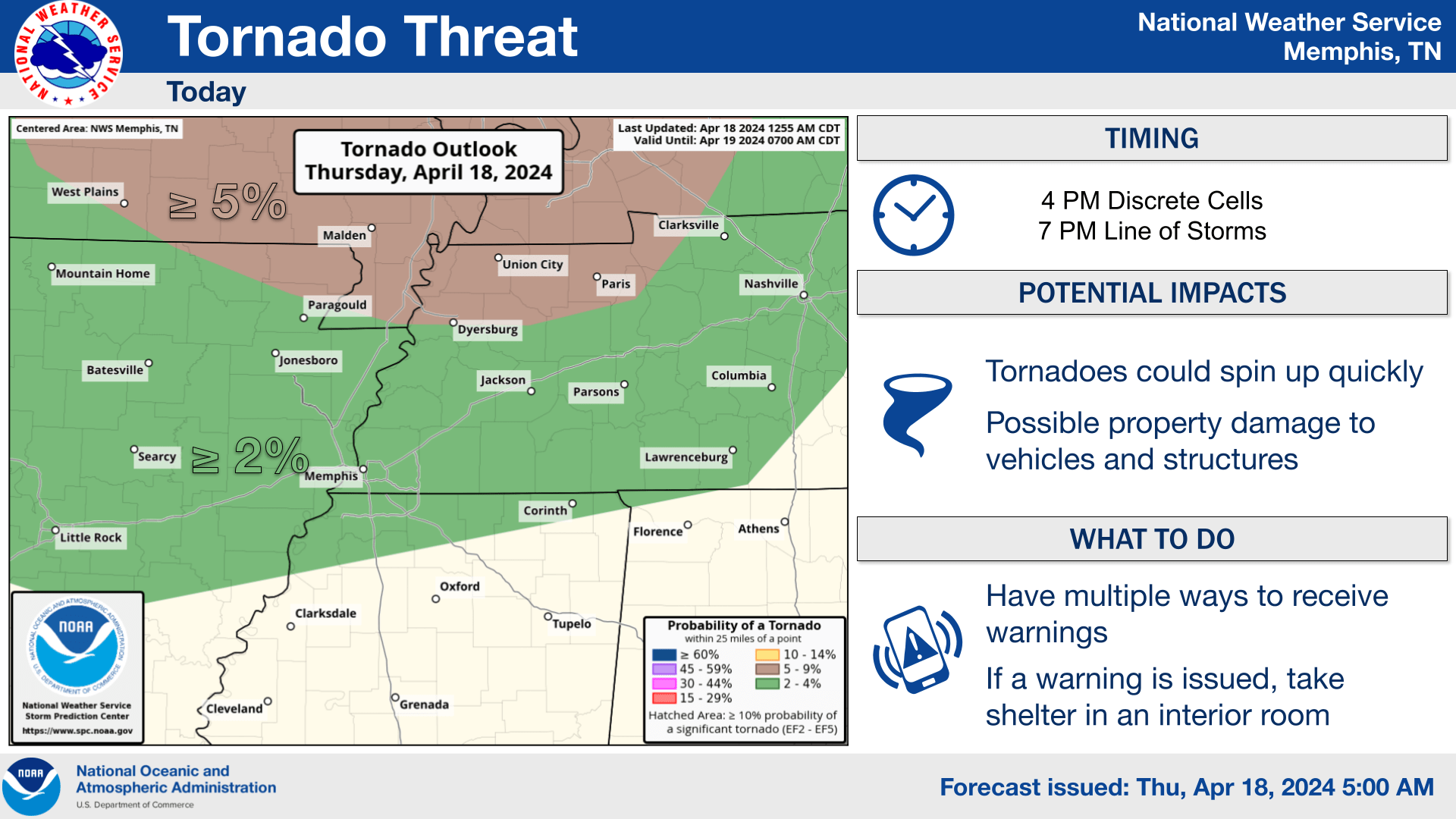
- If the atmosphere remains unstable for the line of storms, damaging winds, large hail, and quick spin up tornadoes are possible.
Confidence: Low (2/5) for severe weather impacts across the Mid-South today and tonight.
Our severe weather coverage is sponsored by Lindsey Electric, your Generac generator dealer in Jackson. Call 731-423-1580, or visit Lindsey Electric Service dot com. Lindsey Electric – The authority for your power solutions.
